
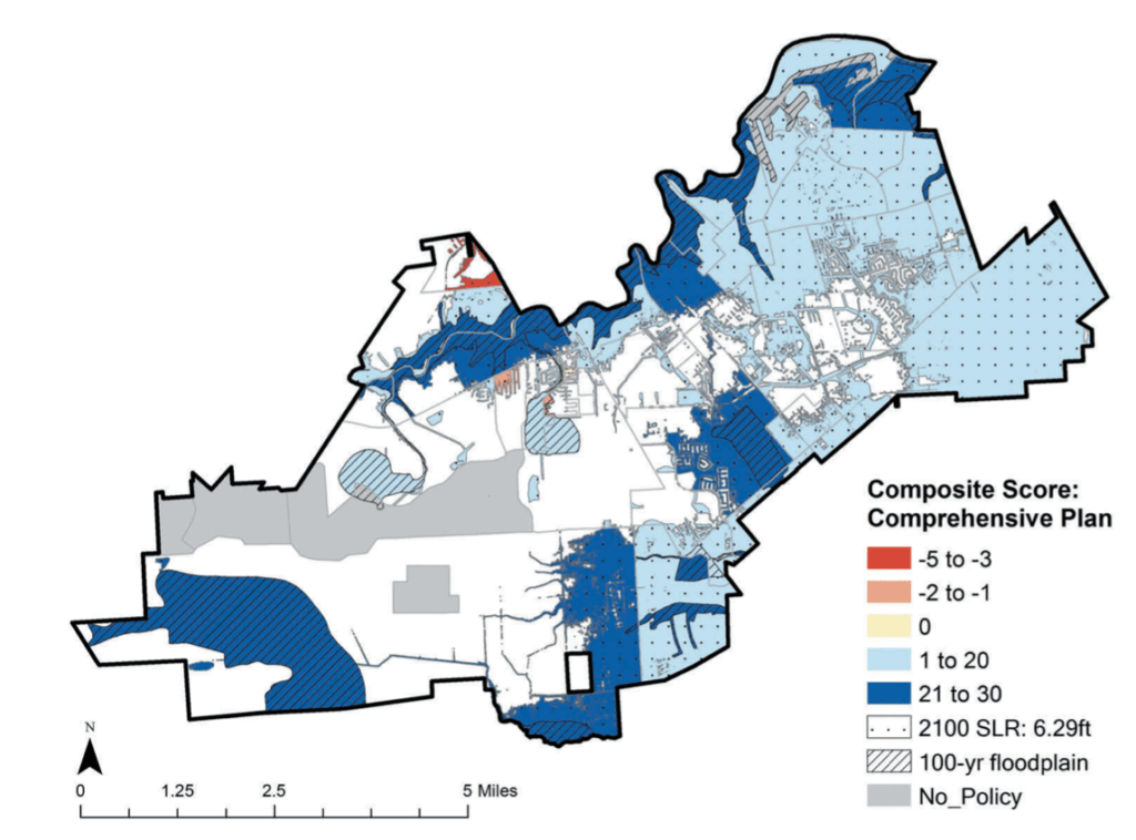
Uncertainty about the impacts of sea-level rise make the ability to forecast future spatial conditions a necessary planning/design tool. Geodesign integrates multiple fields of science with change/impact models and planning/ design strategies. Proactive planning analyses such as newly developed scorecards allow for plan evaluation; design strategies can now be quantitatively assessed using landscape performance calculators. Neither have been explored as Geodesign tools. A Geodesign process was developed using the resilience scorecard to assess flood vulnerability using projections for the 100-year floodplain with sea-level rise by 2100. Projections were used as a guide to develop a resilient master plan for League City, TX, USA. Future impacts of the plan are projected using landscape performance measures.
FROM P.69