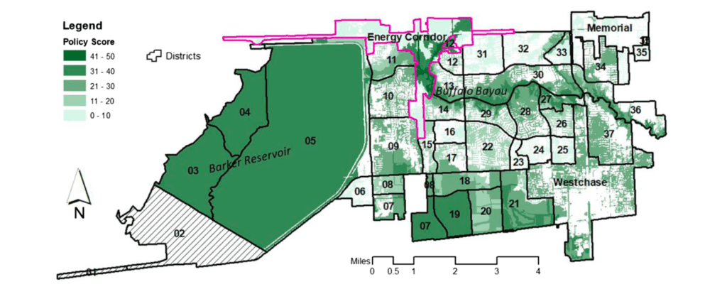
In August 2017, Hurricane Harvey inundated Houston, Texas, where flooding already was a persistent and growing challenge. Coordinated, proactive land-use planning has been shown to help mitigate flooding hazards, whereas conflicting guidance can exacerbate the problem. This study used the Plan Integration for Resilience Scorecard (PIRS) method to spatially evaluate a network of plans guiding land use and development in western Houston when Harvey struck, assessing their integration and effects on flood vulnerability. Despite generally positive results, we found important variations and conflicts across plans and across the study area. By encouraging development without sufficient attention to flood risk, some plans and policies increased vulnerability, especially in places outside the official 100-year (1% annual chance) floodplain but still in danger of flooding. A false sense of security provided by local flood control structures may have amplified the problem by enabling more intense development—an example of the safe development paradox—and making the area even more vulnerable to cascading effects from a massive and sustained precipitation event such as Harvey.

FROM P.6

