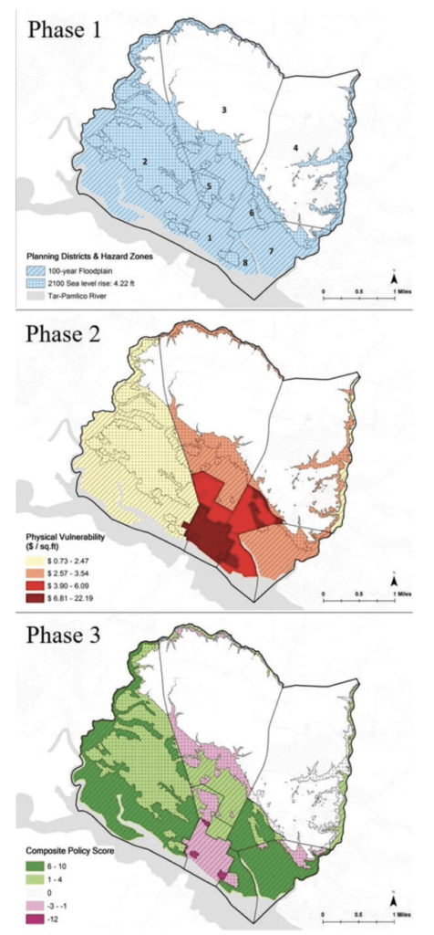
Planning for hazard mitigation is frequently detached from other planning activities that influence development patterns in hazardous areas. Consistent integration of mitigation reduces hazard vulnerability for people and the built environment. We apply a plan integration for resilience scorecard in six US coastal cities to evaluate the integration of local networks of plans and the degree to which they target areas most vulnerable to flooding hazards. We find that plan integration scores vary widely across the six cities, and that some plans actually increase vulnerability in hazard zones. Policies also frequently support mitigation in areas with low vulnerability, rather than in areas with high vulnerability. The plan integration for resilience scorecard can generate information to improve hazard planning by allowing planners to identify conflicts between plans, assess whether plans target areas that are most vulnerable, and better inform decision makers about opportunities to mainstream mitigation into multiple sectors of planning.

FROM P.905

